June 21-23, 2019 – We’d been looking forward to getting up to the Thousand Islands area with our boat ever since visiting Boldt Castle with Ben’s parents several years ago.
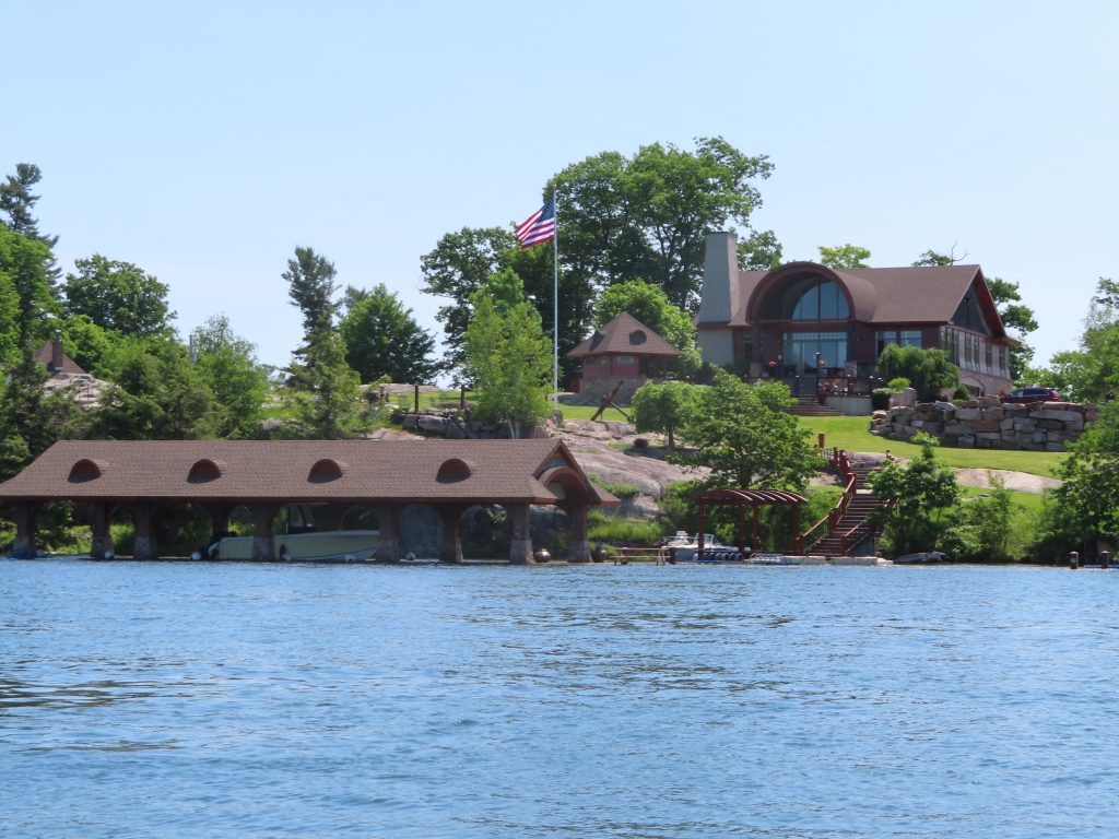
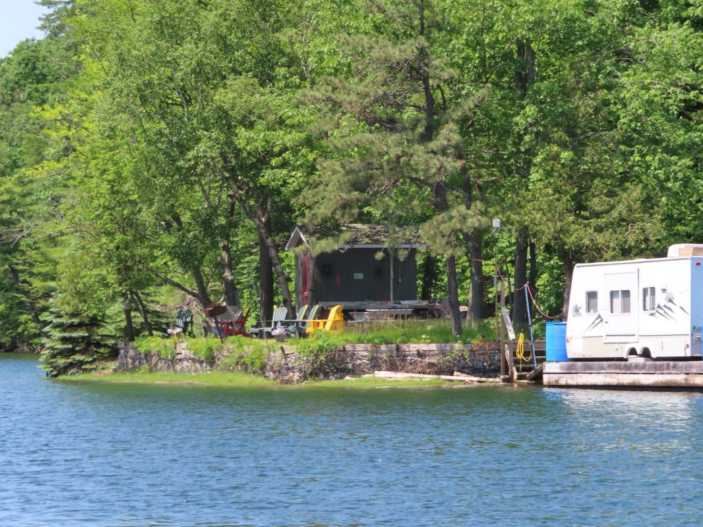
The area is quite stunning in terms of natural beauty, and in terms of the many camps, cottages, homes, mansions (and castles) on the mainland and islands. The water is amazingly clear, and in parts, very deep. However, anywhere near land, it’s all rock — no soft silty groundings here. While the charts are detailed, the high water alters the exact contours a bit, and what might have been an obvious rocky point in normal conditions might be a dangerous granite shoal just inches under the water now.
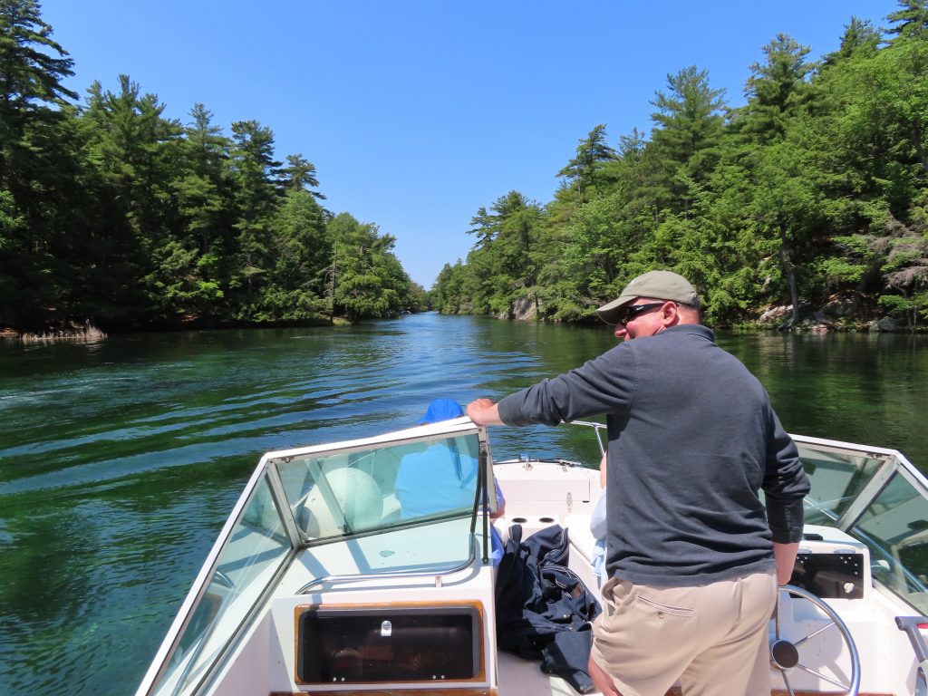
We linked up with our friends Davis and Caroline, who’d grown up amongst the islands as teenagers (oh, the stories!), and recently moved back to Clayton from Baltimore. On Sunday, an absolutely gorgeous day, they took us in their runabout all around their favorite haunts. We got a special closeup view of so many islands, bays and channels, that we lost track.
Straddling the border
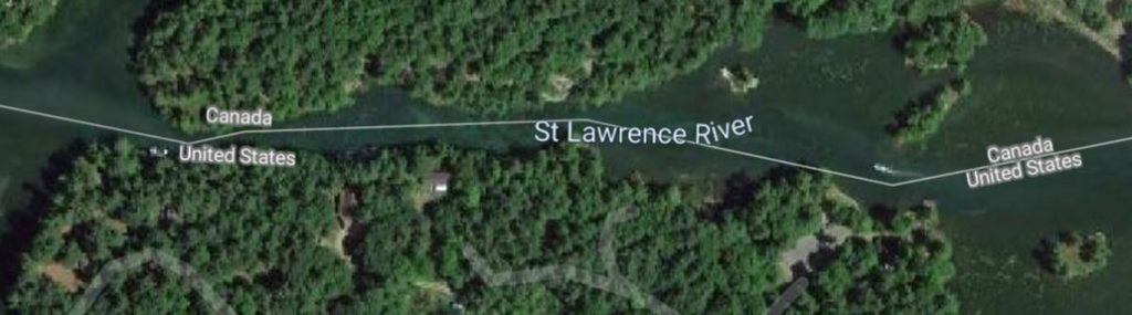
We zig-zagged across the US-Canadian border, at one point going through ‘the rift’ – a very narrow channel, where the invisible dotted line placed Chantale and me in the US, and Davis and Caroline in Canada, all while sitting in the same small boat. Hard to think about how to enforce border laws here when kids can throw a softball underhand between their respective sides.
The ‘international rift’
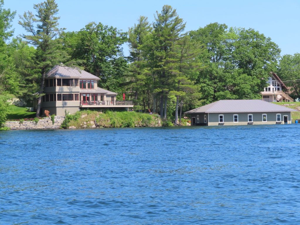
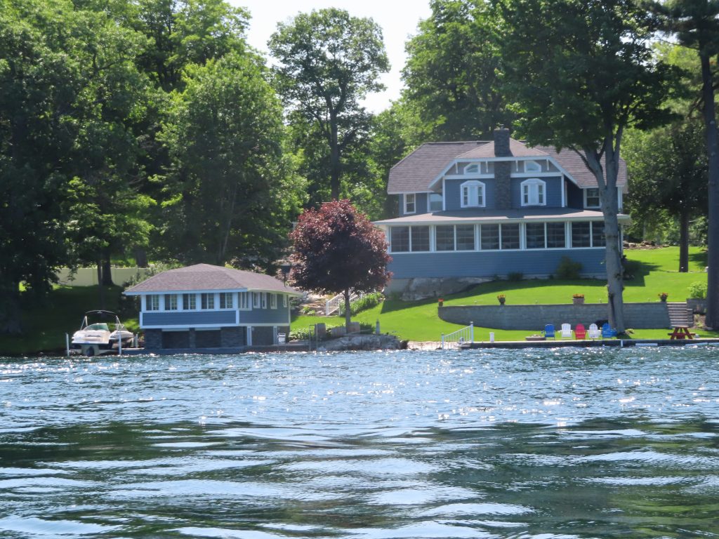
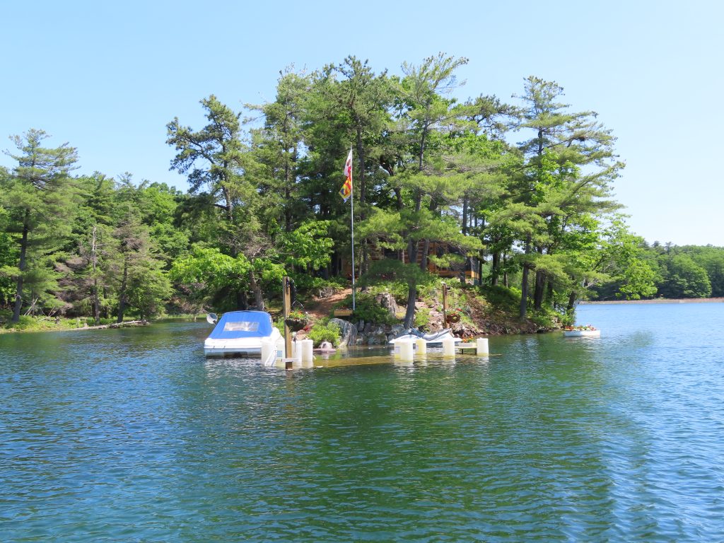
While marveling at some fantastic camps, and some modest ones as well, it was kind of sad, at the same time, to see the impact of the high water on places with fixed docks or boathouses, or even their main buildings that weren’t on high ground.
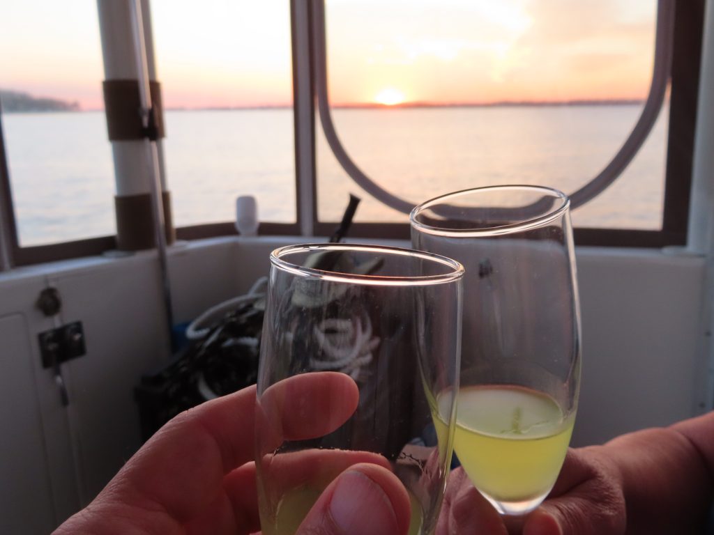
We ended the weekend on the sundeck, enjoying homemade limoncello and a Saint Lawrence River sunset.
June 20, 2019 – We pulled up the anchor early, and headed down into the Saint Lawrence River, as the weather system brought the area some more (unneeded) rain.
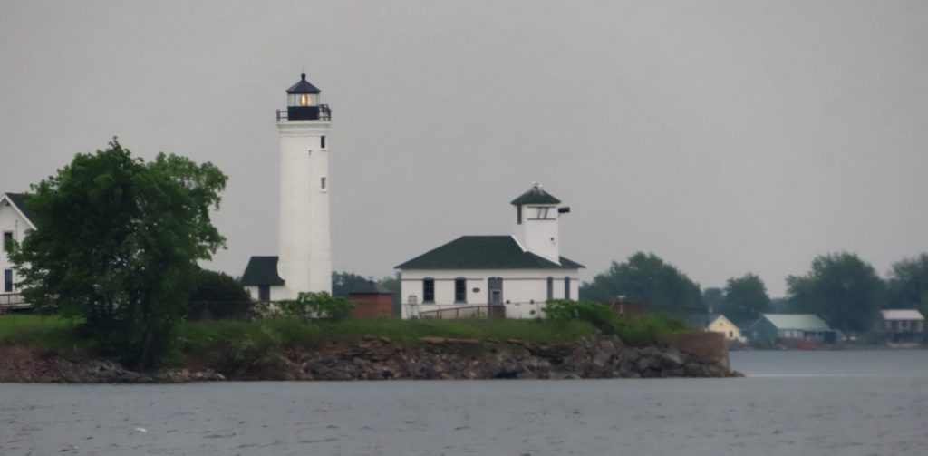
Lighthouse at the end of Lake Ontario entering the St Lawrence River
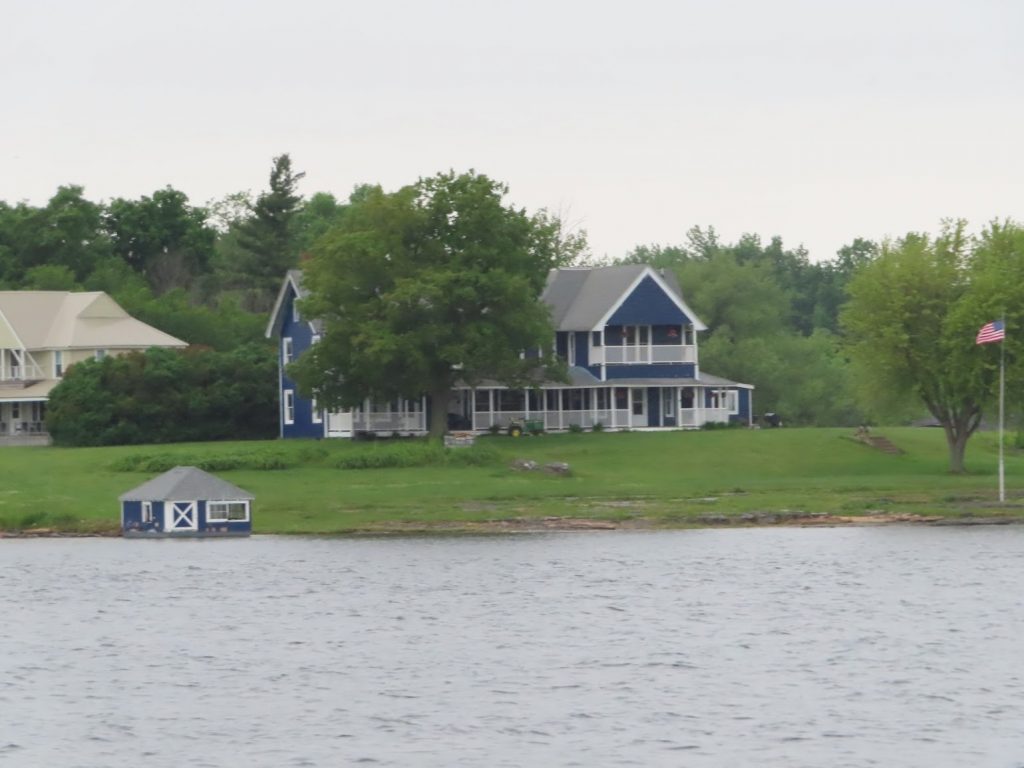
The area has had historic levels of high water, and many waterfront facilities have been flooded. Some marinas in Oswego, and along the Thousand Islands, have had to close, or to turn off electrical power to their docks. Here’s an example of a property that probably had a six foot seawall, and a nice boathouse.
It rained pretty much all the way to Clayton, but the winds stayed around 10, and the waves never picked up. There was some debris in the water to look out for, including a strange little ‘floating island’ with tall grass on it. ?? We stayed within US waters here, but were quite close to the ‘dotted line’ that marks the actual border. It would have been OK to cross it, as long as we didn’t anchor, dock, or rendezvous with another boat. Later, but not today.
We encountered a small, 1-car, ‘stealth ferry’ at one point, that wasn’t on AIS, and didn’t seem to register on our radar either. What the….?
By 11:15, we pulled into Clayton to dock at the town dock right next to the Antique Boat Museum. Rainy and blustery, wasn’t much fun getting tied up, but looking forward to a few days visiting Dave and Caroline, and seeing the Thousand Islands area up close, with that all-important ‘local knowledge’.
June 19, 2019 – Partly sunny, winds variable at 5 knots, waves under 1 foot. It doesn’t get much better than that to cross Lake Ontario. Many Loopers head directly across the lake to Trenton, Ontario, to head directly into the Trent-Severn Canal. We will go up into the Thousand Islands for a few days, then cross the St Lawrence River to Kingston, then work our way back to the west to Trenton later next week.
We had discussed with Justified the possibility of anchoring out together, so we headed out the final lock together.
Lighthouse at Oswego seawallFlat, flat, flat – the hazy sky and reflective water made it hard at times to discern the horizon
And deep!
As it turned out, Justified decided to head on to Kingston after rounding Galloo Island with us, while we headed a bit further in to find a nice sheltered anchorage for the NNE winds that were to start up overnight.
June 18, 2019 – As the last boat to dock for the night, we had been squeezed onto the fuel dock. Just before closing time, the dock attendant came down to say that several other boats wanted to come get fueled up first thing (at 6 AM!) in the morning, so ‘could we be prepared to shove off by then?’
Well, sure we could. (Grrrr. )
So, with nobody making so much as a move toward the fuel dock by 6:15, we left anyway, for the 3 miles to the first lock, where we’d have to wait until 7 AM to lock through.
Surprise! After we idled in and tied to the wall before the lock, the lockmaster told us that if were ready, he’d go ahead and lock us through early (at 6:30!). Sweet justice.
After just one more lock on the Erie Canal, we came to Three Rivers, which represents a choice – go left to the Western Erie Canal to Buffalo, or go right, to the Oswego Canal, to Oswego and Lake Ontario.
We take the right.
There are seven locks to pass through on the way to Lake Ontario, all going down. A couple had bridges going across the locks at the far end. One lock lowered us enough that we could clear the bridge entirely. Another one required a bridge to be lifted as well. As we were exchanging morning pleasantries with the lockmaster, he told us that the bridge had been a bit finicky, so he was going to lower us, raise the bridge, and only then open the lock, in case there was a problem. Great. The bridge creakily got about this high and no higher – don’t know if that was the design, but he opened the lock and we slid under on the far right side and were just fine.
That’s as far open as it’s going to go??Getting pretty comfortable with all this locking…2 more to go and done with NY canalsA 20 foot drop of the lock here- the outlet will probably be a bit turbulent as it mixes with water coming over the dam
When we got to Oswego, we held up between Locks 7 and 8, which are only separated by about a half mile, and tied up along the park there. We had planned this stop, as it kept us out of any weather that might blow in off Lake Ontario, and if the conditions looked bad we could just wait it out, or if they were good, we’d pass out the final lock and head directly out in the morning.
It was a popular spot, and several more boats came in after us, including Justified, who we had followed into Sylvan Beach, and Vector, who we had leapfrogged many times, but never actually met until today.
Ahhh, nice close cut on the sides
We rode our bikes (uphill both ways, ughh) to go shopping, and later walked up over the bridge to the other side of the river where Chantale got a long overdue haircut at a classy old-time men’s barbershop.
We played a neat dice game over on Justified after dinner downtown, where the crew of BIG also joined us.
Overall, a good day – tomorrow, to the Thousand Islands.
June 16-17, 2019 – We stayed on the boat at Sylvan Beach all day Sunday while it was raining, catching up on some paperwork and small projects. We then headed across Oneida Lake the next morning. Very quiet conditions, but a lot of small fishing boats out, and apparently the best fishing is on the most direct route that we and other through-cruisers have to take to get from one end of the lake to the other. Sheesh.
Fuel tanks had gotten below 1/2, and it was reported that we were coming up on some of the best diesel prices before we crossed into Canada. We stopped to fill up for the first time since the coast of New Jersey – $637.45, and then stayed along with a number of other Loopers at Winter Harbor.
June 15, 2019 – Another day with wind in the forecast, but it was nice and calm as we left the marina at 6:45 to hit the first lock, 3 miles away, soon after his 7 AM opening time.
I’ll pass that red marker AFTER he goes by
The two tugs we encountered pushing barges, one a double, must have been granted early locking, as we heard them on the radio, and encountered both before we got to the lock. It was just a bit dicey to pass them on the narrow, curvy canal, but we slowed at the widest spot we could find and they came around the corners wide so that there was never any trouble.
Long, straight view down the canal
The view in the mornings is just beautiful, and reminds us of getting up early at Chateauguay Lake to waterski or wakeboard on the glassy surface before the wind kicks up.
Flashback! (not on the Loop)
We caught up to another boat, Justified, on this leg, and wound up going through the locks with them, and chatting along the way. They had stayed at the Ilion Marina, below, and done a tour of the Remington museum (unfortunately, the factory tours of at the Remington Arms factory had been discontinued a few years ago).
Cute little marina at Ilion, NY. Note the tugboat ‘Governor Roosevelt’ that we had seen back in Little Falls.
Lock 21 marked the point at which we begin locking down – entering the chamber that is already full, and then riding it down as the water is emptied into the lower segment of the canal. MUCH smoother. However, a little more challenging with a crosswind, as the boat’s superstructure is fully exposed to the wind as you are coming into the lock, and having to reach down over the side of the boat with a boat-hook to snag the lines is a bit trickier as well.
The closer we got to Oneida Lake, the more recreational traffic we saw, with pontoon boats, bowriders and fishing boats going up and down the canal, with some small marinas off in side creeks for small day boats. Law enforcement was quite visible, both the NYSDEC and the local sheriff.
Sylvan Beach is a resort community, with a beach, amusement park, and numerous shops and restaurants. We were probably fortunate that the weather was less than gorgeous (actually, overcast, cool, spitting rain and very windy), as there could have been even more congestion along the long free dock wall that accommodates both temporary and overnight boats. As it was, we had to go almost to the end of the wall to find an opening, and were quite exposed to the wind and waves that rocked us all evening.
We met up with the crews of Justified and 9 1/2, for dinner at the Crazy Clam, and then turned in early, after an 8-hour travel day through six locks.
June 14, 2019 – The docks at Little Falls were jam packed yesterday when we got there, but by 10 AM, we were all by ourselves.
Hogging the dock at Little Falls
The dockmaster was going to head to town (which is up over a bridge on the other side of the river), and offered to give us a lift and see some sights. He first drove up to an overlook where we could see back down the Mohawk Valley along the route we had traveled the day prior.
A view back down the canal near Little Falls
We then went by the Herkimer estate, the town ball fields, and a stone bread oven built by Italian immigrants in the 1800s when many of them worked constructing the canal. Then Mark dropped us off at the community co-op, where we picked up a few unique items before heading across the street to the Price Chopper for more provisioning. We loaded our small bike trailer with the goods, and crossed the main street in the rain to duck under the canopied sidewalk. We stopped at Ruggerio’s, an Italian restaurant that we’d been told about for its delicious food and gigantic portions. All true – we each ordered a cup of soup, that came out in huge bowls – ‘wait a minute, we only ordered a cup’ –‘no, that’s the cup size here’. The food was also great, and we brought some of it back to the boat for later.
We returned to the marina to find ‘9 1/2’, another Looper boat had pulled in – we had crossed paths with them briefly back at Norrie Point. In the evening, we scoped out the route we’d transit the next week or so up to the 1000 islands, and got ready for a long day on Saturday.
June 13, 2019 – We knew it would be a wet day, but hoping to beat the wind that was to pick up later, we called Lock 14 at 7:01, and let him know we were ready to cast off from the Canajoharie town dock, and head to the lock, that we could see a few hundred yards away, as soon as he was open. He probably downed his first cup of coffee as he readied for us, and we were in the lock shortly after that.
Ooh, this is sure fun!
During the route today, we traversed a section of the canal that was NOT actually the Mohawk River. It was much narrower, and straight between some angular corners. We could see a bicycle path along the side, where the original mule towpath would have been.
Narrow and straight….like a ditch
Soon we came to Lock 17, the biggest lift on the whole system, at 40 feet. It is also unique in that only it, and a lock in Canada, have a ‘guillotine’ gate at the lower end, that lifts to let boats go underneath, rather than open like gates at all the other locks on the canal. It had a tug with a barge in the chamber locking down when we arrived, so we and another boat had to wait on the wall until it was clear.
Giving him plenty of room
Then it was our turn to enter the lock under the lift gate- it’s supposed to be 20′ clearance, and our antennas are 19′ – we made it fine into the deep chamber, right behind another Looper boat.
Wow, it’s definitely imposing once inside- see the man crossing the top of the gates.
The other boat had two people on the lines, to hold the boat in placeBut we found that we could do it with just Supergirl on the side deck by herself (and the Captain at the helm to make slight adjustments with the engines left running) – much easier on the backs and arms
It was a long, slow lift, and we were glad to finally get through and onward toward the town of Little Falls. Very interesting how some of the homes actually had balconies right over the water!
Waterfront properties.
We got a bit of a treat as we came up to the small park on the right- an old-time tugboat, that is actually still in use on the canal. In speaking with the head of the Little Falls marina, it turns out that his son is the captain of the Governor Roosevelt.
We pulled into the really nice town marina at Little Falls, one that we had heard other Loopers rave about. We quickly got the run-down from all the Loopers who’d already tried some of the restaurants in town, and gave the boat a hasty washdown for the dirty fenders and side decks. Then, off to the Copper Moose for dinner.
June 12, 2019 – Wednesday dawned clear and sunny. We knew it would be a great travel day, for us and for everyone else, so we cast off early.
(Click above image to pause the autorotation, zoom in or out, or move the point of view)
The water was like glass, and we were smoothly through the first two locks. The color of the trees, sky and water — the North Country!
This lock fills really close to the top – had to make sure the fenders were hung extra lowRail tracks parallel the canal, and we see many passing trains (and often hear them, when we are moored overnight)
As we were going along a section of the river where we could see straight ahead through several bends, the long string of markers started to look a bit funny in the binoculars. What the…..?
The reflection of the red and green buoys, and of the trees beyond, made it look as if the markers were floating up in the air, rather than in the water. (Look at the red ones on the right, and the farthest red/green pair.)
The miles were going by smoothly, until we got to Lock 13; a barge was in the lock, having something unloaded. It would be a “few minutes” said the lockmaster. Yeah, if 45 is ‘a few’.
While we were waiting, we heard another boat behind us hail the lockmaster. I looked back and saw another Looper boat. And another, and another. And one of the non-Looper boats we left at Amsterdam. Up until this point, we had only locked alone. But now we will be in the chamber as one of five.
No problem, plenty of room
First in, first out, so we led the fleet out of the lock and up the canal.
Antisubmarine formation?
With the Lock 13 armada hot on our heels, we peeled off at the town of Canajoharie where we had a couple specific places in mind to see.
Town diner. Check. Great lunch – Ben had the wedge burger. Perhaps a burger with a wedge of lettuce, as in a wedge salad, you might think? Nope. Wedges of fried macaroni and cheese on top of the burger.
Arkell Museum. Check. Nice small museum, with an early American, Mohawk Valley angle. Seven Winslow Homer pieces, a Gilbert Stuart copy of his George Washington portrait, a Remington statue, and more.
Boiling pots. Check. The town’s name is said to be a Mohawklanguage term meaning “the pot that washes itself,” referring to a circular gorge in the Canajoharie Creek, just south of the village. We took a 3/4 mile hike up the hill to find the smaller falls in the creek and the location of these circular formations.
The largest of several circular holes formed in the shaleWe walked several hundred yards down along the dry rocks on one side of the falls, looking for good photo shot opportunitiesEnjoying the day off the boatWe saw this grackle (?) flitting from rock to rock, obviously hunting for something – a few minutes before, we saw him actually catch something, perhaps a bug or a tadpole. Not what you’d think of as a ‘water bird’
We hung our feet in the water for a while, before hiking back down the hill. We’d seen Jim’s Irish Harbor Pub on the way up, and figured it’d be worth a stop on the way back, to give hot and weary travelers something cold to quaff their thirst.
O.M.G. What an experience. We were regaled by the extremely genuine Irish-American proprietor, Jim, and his mother, Mary, with a wide variety of tales. Both Jim and his father were in the Merchant Marine, and three of Mary’s children served in the Navy, hence the ‘Harbor’ in the name. Jim presented Chantale with a Guinness hat before we could depart. Truly one of the most memorable encounters with locals that we have had so far.