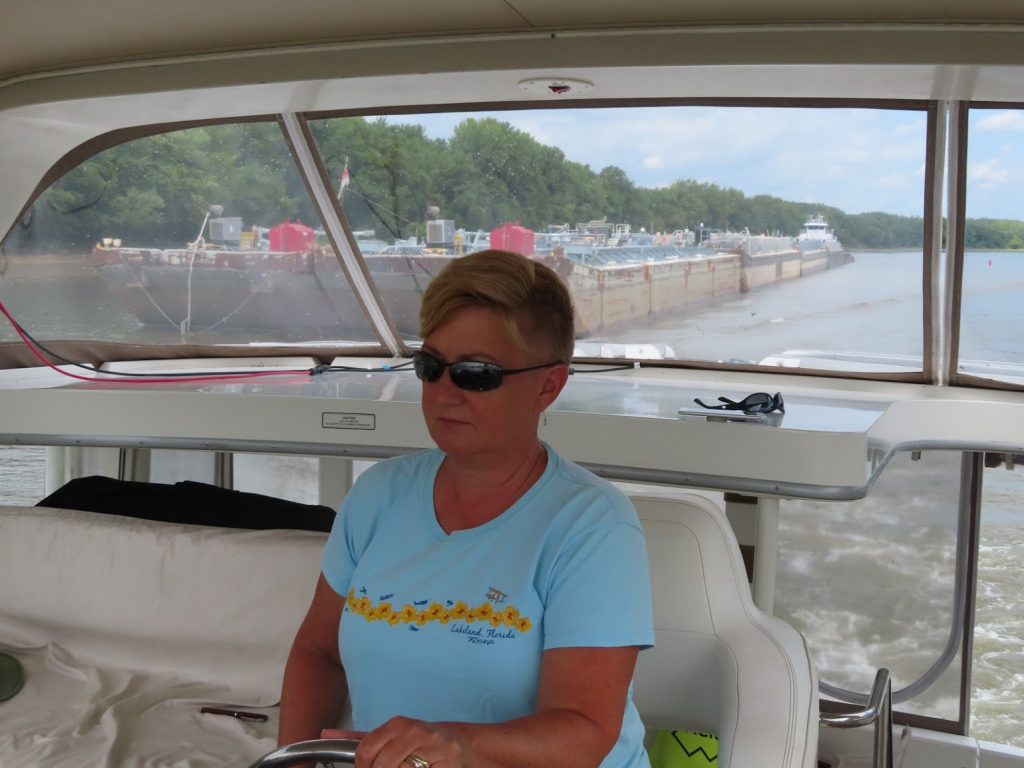
Barges, barges, and more barges

August 30, 2019 – Once south of Chicago, we transition from the Chicago River to the Chicago Sanitary and Ship Canal.

Ewwww!

Condensed, from our friends at Wikipedia,

The Chicago Sanitary and Ship Canal, historically known as the Chicago Drainage Canal, is a 28-mile-long (45 km) canal system that connects the Chicago River to the Des Plaines River. It reverses the direction of the Main Stem and the South Branch of the Chicago River, which now flows out of Lake Michigan rather than into it. The related Calumet-Saganashkee Channel does the same for the Calumet River a short distance to the south, joining the Chicago canal about halfway along its route to the Des Plaines. The two provide the only navigation for ships between the Great Lakes Waterway and the Mississippi River system.

The canal was primarily built as a sewage treatment scheme. Prior to its opening in 1900, sewage from the city of Chicago was dumped into the Chicago River and flowed into Lake Michigan. The city’s drinking water supply was located offshore, and there were fears that the sewage could reach the intake and cause serious disease outbreaks. Since the sewer systems were already flowing into the river, the decision was made to dam the river and reverse its flow, thereby sending all the sewage inland where it could be treated before emptying it into the Des Plaines.

You can bet the cities downstream weren’t to happy about that.

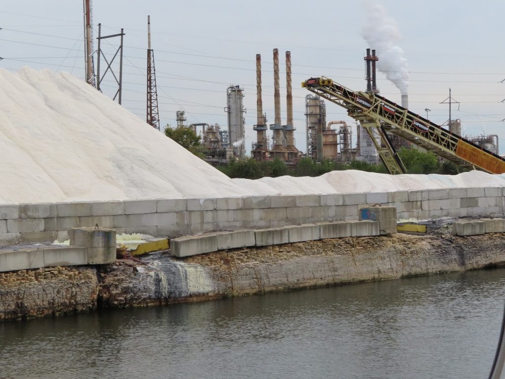
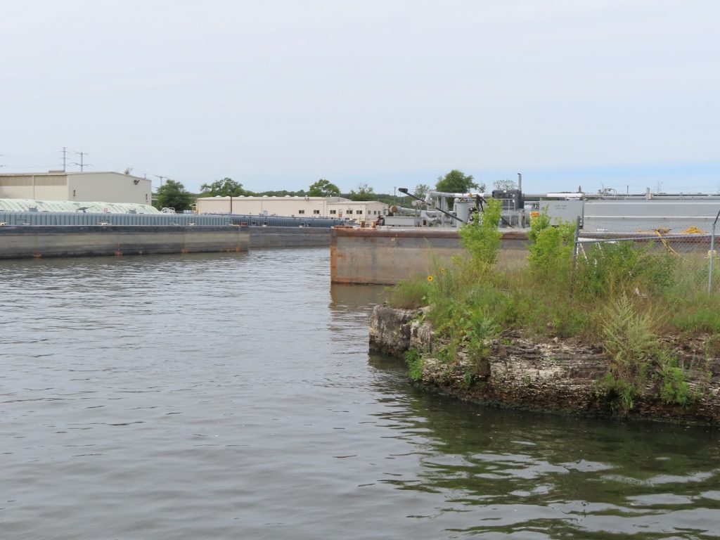
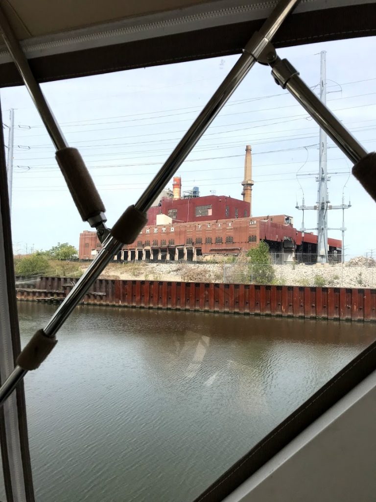
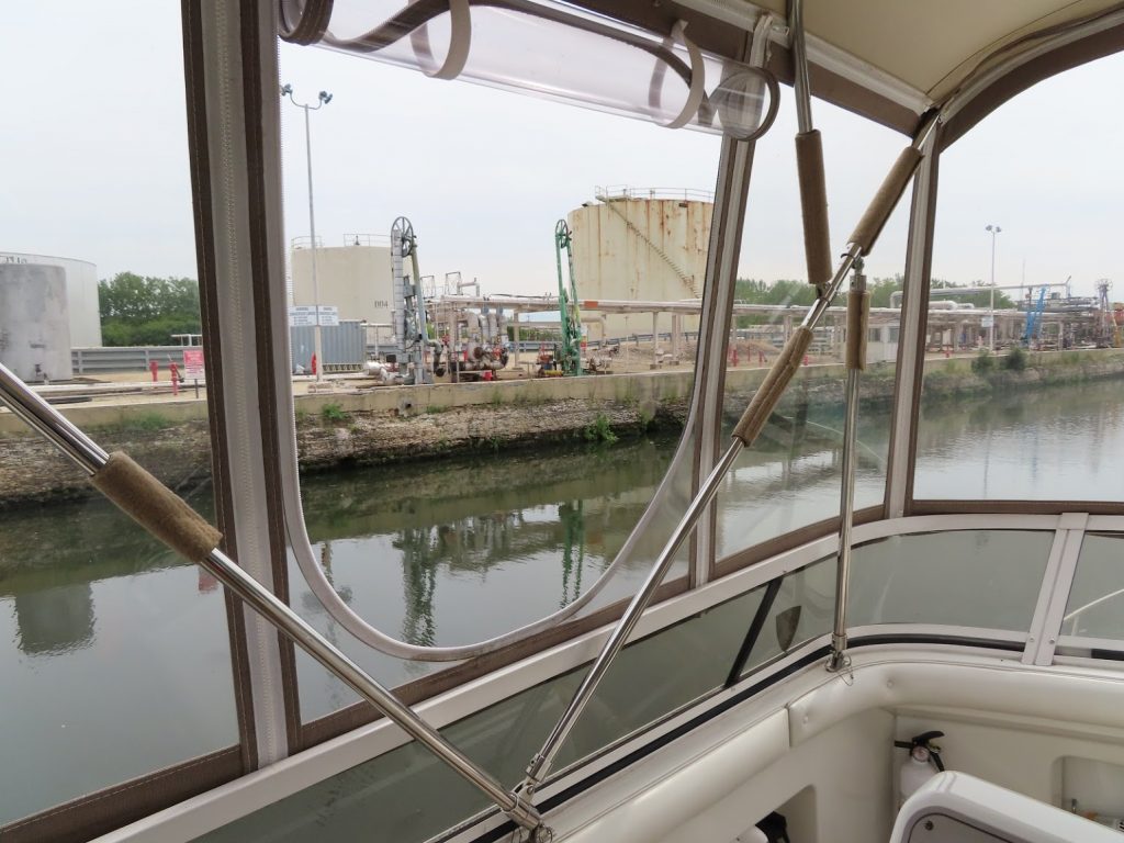
Anyway, we begin to see very industrialized areas, and many, many barges staged (either loaded or unloaded) for carrying goods up or down the river.
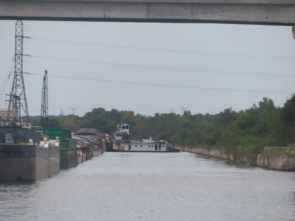
Waited for 20 minutes while this tug worked at repositioning some barges.
First of many we’d see, and pass
The tows aren’t very fast, so everything around them seems to happen in slow motion. Inexorable, stressful slow motion.

We love our AIS, which lets us see the position, movement, and most importantly name, of the tugs and tows up ahead. Is that one moving? Which way? What’s going to pop out of a staging lagoon? How far ahead is he?

We rapidly get into practice with hailing them on the radio, to work out when, and how, it’s safe to pass. It’s nice to be able to say “David Evans, this is At Ease, downbound pleasurecraft, half-mile out, how would you like me to pass?”, instead of “hailing the tugboat… I am a pleasurecraft way out in front of you, and….uh…want to pass you.” I can see them, and more importantly, they can see me, and have been watching me on their screens even before I call them, and can very easily work out whether I should hold back, or go by on the right (‘one whistle’) or on the left (‘two whistle’).

And then we get to this:
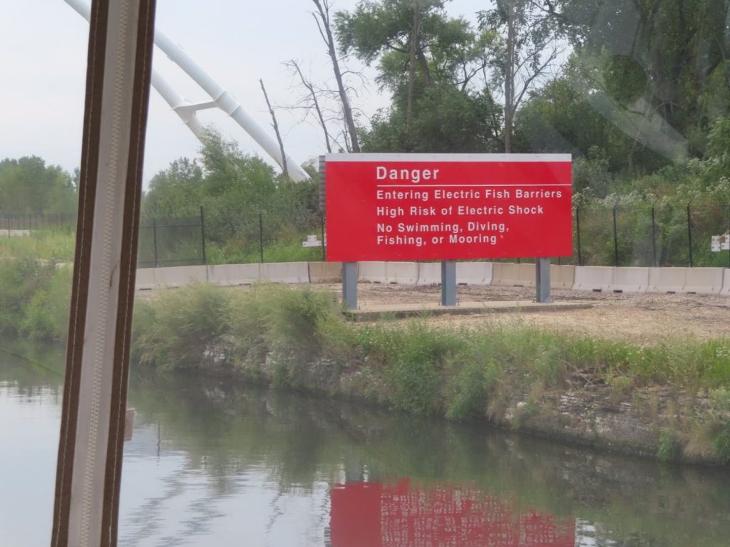
The barrier is to control the Asian Carp, an invasive species, that are making their way up the Illinois River. (More on them later.

Cue the soundtrack…

We come past the junction of the Calumet River, and some of the scenery become a little more bucolic. We are planning to make it to Joliet, to tie up at their riverfront park (for free!), after passing under a few lift bridges that the operator tells us are 16’6″. Hope we measured right!
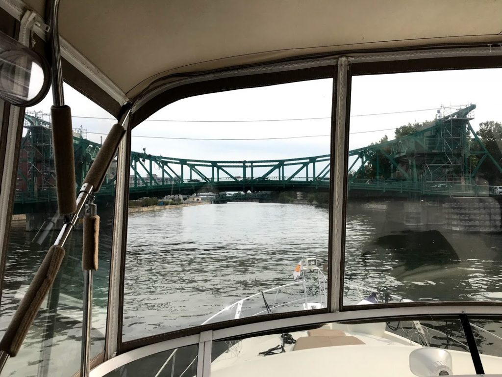
It was tight, but we did.

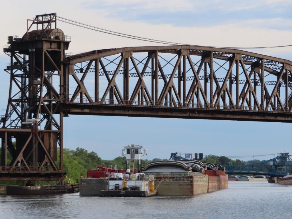
Later, from our spot on the Joliet wall, we watched the bridge lift for a tow.
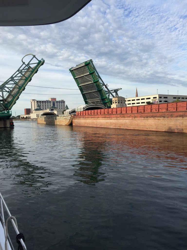
Later that evening we were contacted by another Looper boat, The Lower Place, coming in after dark; we helped them tie up, and then wound up traveling with them all the way to Alton, IL.

But that’s the next chapter…

At Ease takes Chicago

August 30, 2019 – What better way to kick off Labor Day weekend than taking your own boat through downtown Chicago?

We’d taken the architectural boat tour, and ridden a water taxi from Chinatown back to the city center, so we had a feel for the waterway itself, and how busy it could be. It would have been nice to head down right at sunrise, to avoid some of that, but there was an Amtrak railroad bridge that would need to be raised for us, and with morning commuter trains, we were concerned about being trapped there for hours, so we planned to hit it around 10.

We measured, and measured, to convince ourselves that we could clear a fixed railroad bridge south of Chicago, with a clearance of 17’6″. It’d be terrible to get there, and have to backtrack. We normally are 19′ high, to our antenna tips, but we folded down our antennas and the radar mast, to make us 16′. We are pretty sure…

We installed the radar unit and these antennas on a hinged base, to enable us to reduce our air draft like this; the two VHF antennas, on the sides of the radar arch, also pivot to fold down.

The Chicago Harbor Lock, separates the Chicago River from Lake Michigan, and we left our mooring for a short 15 minute trip into the lock, then, it’s into the city.

We took this picture of the lock from atop 360Chicago. Note that due to high water on Lake Michigan, the breakwater in the lower part of the photo is underwater.

After clearing the lock, it was one bridge after another – these are mostly 18-20 feet, but they sure look close! We had to be alert for the water taxis, which zigzag back and forth from docks on either side, and stopped a few times to let them go.

Here are some videos taken while going through the city.

Our friends who had gone through a day earlier had to wait for three trains at the Amtrak bridge, and told us to plan to hit it after 10. We did, but still had to wait about 15 minutes before it would lift for us – here’s a video of the lift.

The trip from here began to get more and more industrial, and pretty soon we are facing the lowest fixed bridge (it opened, once upon a time, but not any more) that we have to cross under in order to continue.

This is the bridge – if we can’t clear it, we turn around…
It looks low, but the gage on the side tells us it’s well over 17, so we should be OK…

To be continued…

Let’s just pick it up in Chicago, shall we…

August 27, 2019

<sigh…someday we will go back and fill in the details, but we are going to start fresh, at the south end of Lake Michigan>

We’d made a great choice to head out of South Haven, Michigan and down the lake on Monday, as a stretch of high winds were coming that would have locked us down for days. A quick overnight at Michigan City, Indiana, and then onward for a quick pit-stop for fuel in Hammond before we pressed on for Chicago. At the bottom of Lake Michigan now, we were now heading due west, into the wind and waves.

We were able to make out the Chicago skyline from almost 30 miles away, and the waters started to get a little busier with commercial traffic around the port of Calumet, from which cargo could be sent down the Calumet River to the Gulf.

We stayed at the Monroe Harbor mooring field – easier and more secure than anchoring, and cheaper (but less convenient) than a marina. With a tender service that would come out and pick us up at the boat, we had a great location from which to explore the City. What a view!

The weather was spectacular the week before Labor Day, other than windy (but hey, it’s the Windy City, right?) and we were able to take in the Navy Pier, deep-dish pizza (Gino’s East), go to a skyscraper for the high perspective, Chinatown, the Bean, and the Art Institute of Chicago, during our three-day stay.

In preparation for taking our own boat through downtown, we took an architectural boat tour; the docent did a great job pointing out the historical context of many of the highlights, and we took many pictures, knowing that we might be just a tad occupied when we had the wheel ourselves.

We enjoyed the final Wednesday night fireworks show, put on at Navy Pier, from the deck of our boat, and enjoyed the night skyline.

First 3 Months – Recap

August 19, 2019 – It’s been three months since we cast off lines from Herrington Harbour North, and started off in earnest on our ‘forward progress’ Loop.

We’d actually left on May 1st, of course, headed south to the America’s Great Loop Cruisers Association (AGLCA) Spring Rendezvous, in Norfolk, Virginia. That was 171 miles in the ‘wrong’ direction, but gave us a shake-down cruise, of sorts, and we felt pretty good about things as we completed the 323-mile roundtrip and docked once again at our home slip, to tend to a few last-minute details at our home port, before really leaving.

Over the last three months, we have traveled 1736 miles through:

  • The Atlantic Ocean
  • Three major rivers (Delaware, Hudson, St Lawrence)
  • Three Great Lakes (Ontario, Huron, Michigan)
  • Five states (Maryland, Delaware, New Jersey, New York, Michigan)
  • Two countries (US and Canada)
  • 74 locks , in two lock systems (NYS Erie/Oswego Canals – 30 locks; Trent Severn Waterway – 44 locks)

We have moved the boat on 56 days, and remained in place 37 days; on the days we moved, we averaged 31 miles, although the shortest was 0.5 miles, and the longest was 99.5 miles.

We spent 50 nights in Marinas (54%), and 27 nights (30%) at anchor; as well as nine tied to a non-lock wall, three mooring balls, two free town docks, and 2 locks.

We have not slept ashore, nor driven a car, since leaving home.

Biggest Challenge: Not having a ‘normal day’. You’d think that maybe we’d settle into a routine, and one day would start to seem like the next. Just get up, do all the same things just like you did them yesterday. Nope. The myriad of variables and possible contingencies, seem to increase exponentially when we are deciding if and where to move our home tomorrow, and then further morph overnight. We adjust, and then begin the day, and there are another whole set of circumstances that mean the day may not go exactly as we thought it would. Wind. Waves. Current. Our boat. Other boats. Locks. Never the same waterway twice. Never returning to a ‘home slip’. Every maneuver is in strange water, whether navigating a tricky shoal, or pulling into a strange dock.

We feel fortunate to be able to undertake, and so far successfully accomplish, this incredible journey, supported by the camaraderie and friendship of so many other boaters we have met (Loopers and otherwise), and the well wishes of so many friends and family from afar.

And we have gained new confidence in each other as a team with all the skills, ingenuity, persistence, patience, and character we need to thrive in meeting the even greater challenges that lie ahead.

Into the Georgian Bay

July, 2019 – Our first stop in the Georgian Bay, after we exit the final Trent-Severn lock at Port Severn, is at Bayport Marina, in Midland. We topped off our fuel tanks (for the first time since Brewerton, NY), bought a few spares, went to the grocery, and generally got ready to head away from the controlled, linear aspects of the trip to date, into the 30,000 Islands area of the Georgian Bay of Lake Huron.

Lot’s of unforgiving granite if you don’t pick the right course!

From some local PR materials: the 30,000 Islands of Georgian Bay represent the world’s largest freshwater archipelago. Part of the Canadian Shield, the islands are thought to be the eroded roots of an ancient mountain range called the Grenville Mountains.  The granite-sculpted shorelines of the islands, exposed by the glaciers at the end of the last ice age, and the windswept white pine forests that adorn the islands, create numerous distinct habitats that support a variety of both well-known and rare species including plants, mammals, birds, reptiles and amphibians. The uniqueness of the island ecosystem earned the area World Biosphere Reserve status from the United Nations in 2004.

We will detail and explain some of the highlights in individual posts to come, but in the meantime, we were finally able to get some pictures uploaded, that you can peruse to get a general sense of the area.

There are some marked channels (thankfully!) that weave in, around, and between the absolutely overwhelming numbers of islands, where depths can go from a hundred feet to three feet in just a few yards. And the cruising guides, after describing some fantastic anchorage or other site, will say “once off the main channel, post a bow watch and proceed slowly.” <gulp>

So enjoy the pictures at this shared album.

The Big Chute

July 15, 2019 – And now for something completely different.

Your boat floats in all the other locks. But for this one, you drive onto a ‘rail cart’, and it takes you out and over a hill with a a road, and down the other side back into the water.

With you on it.

We docked the boat first, so we could get off and take a look at it up close.

Here comes the cart from the other side, after letting off the boats in the distance.
We will be on the back of the cart, so our props can hang off the edge while our keel sits on the bed. Lifting straps hold the boat steady…
I’m ready…are you ready?

We start the boat up and move to the ready line, and they give us directions over a loudspeaker to approach the cart. Once we are close, we can talk to the lock staff that are up on the cart, for final instructions. Once the boat is in place, we shut it down and just enjoy the ride.

Slings are tight, ready to go…

Oh boy! Its slow and smooth, but definitely an E-Ticket ride…

I wish I had the picture this guy took of us going over the road
Feel like putting your arms up in the air to go down this ride? They’d get pretty tired by the time you’d reach the bottom.
(note the attendants chatting on the side of the cart)

Roll the footage-

The short leg from the Chute to the final lock at Port Severn seemed a bit anticlimactic, but even that lock had a little something in store, with stiff breeze at the top, and the fact that it is the smallest lock on the system. They squeezed us in with two smallish bowriders, and down we went.

Goodbye, Trent-Severn; we’re in the Georgian Bay!

Past the railroad bridge from hell, and into the Lost Channel

July 14, 2019 – A fair bit of the conversation at Orillia among the Loopers was getting past the railroad swing bridge on the way to the Big Chute. Lot’s of rumors with regard to how long a wait we might have, and whether the bridge tender hated all boats, or just Loopers.

‘He’ll make you wait, just out of spite’,

‘I heard a boat was trapped there for two hours’

A group of us decided to make a run for it en masse, so at least when it did open, we could all get through before it closed again.

We wound up having to hold station in a very narrow rock lined channel for almost an hour and a half; but we could hear a couple trains go past, so it appeared that it was legit. Finally, it swung open, so off we go!

Finally, past the infamous bridge

We had a few more tight areas to traverse, but they were of the more natural variety, not the straight hand-dug canals that we had contended with before.

Securite, securite, securite: five motor yachts entering Mcdonald’s Cut…
The green marker seems just a bit superfluous here
A tricky left ahead, just under the bridge

Most of the other boats were pressing on to the Big Chute marine railway, but we pulled off into the Lost Channel, several miles up a river to a nice dead-end anchorage with pretty views just a few camps. Another Looper boat joined us later in the afternoon, and we were both treated to a twilight waterskiing demonstration.

View to one side of our Lost Channel anchorage
Fish E Business also found the Lost Channel
Ahh, skiing at sunset

In the morning, a pristine antique motor launch came motoring past, and stopped off at one of the nearby camps

A nice sendoff as we head for the final locks of the Trent Severn Waterway, and out into the Georgian Bay.

Port of Orillia

July 10-13, 2019

We got an early start on leaving Kirkfield Lift Lock, hoping to get through some more tight stretches without encountering oncoming traffic again. Fortunately, a very quiet morning, and no more encounters on the way to Lake Simcoe.

We went through some weedy patches in Canal Lake – yuck! Luckily, didn’t suck any into our engine cooling system.
More narrow sections – this one leads to a swing bridge that we had to signal to open
Yup, that bridge was a low one!
Would have been a nicer shot if there wasn’t a slight ripple
NOT an optical illusion – it wasn’t a straight-on arched bridge – it was angled on one side, and rocky shoals tight on each side on the other side – and was clearance measured at the middle, or where our two side mounted antennas were?- SLOWLY!
Canal next to a road, next to a hayfield (approaching a lock – note the headset to talk to Chantale who will be on the foredeck shortly to handle lines for locking)

Finally, through the straight and narrow sections and out onto Lake Simcoe. A pretty big lake (19 miles long by 16 miles wide), we’d heard that on a windy day it could get pretty rough, but we had a beautiful sunny low-wind day for our crossing. At the north end of the lake, we passed through the ‘Narrows’ into Lake Couchiching, to the very protected municipal harbor, right near the heart of downtown, lots of park space and a public beach down the way, with a historic well preserved turn of the century bandstand, park benches, and and the best playground we have ever seen.

On the North American Swingset Tour…

Many nice old houses in town – we had picked up a pamphlet at the marina took a walking tour to view many of them.

We ate the first night at a side walk table, checking out the scene.

The next day we took a big shopping trip on bikes out to the Canadian Tire (sort of a cross between a Lowe’s and a Target). Bought our own floaty seats like our friends introduced to us to, for hanging out in the water behind the boad, and some floating rope so we could stern tie the boat to rocks once we got out into the Georgian Bay, which is apparently a common practice.

A bunch of Loopers on the left, and the gang of boats from Peterborough on the right

When we got back, we discovered that five Canadian boats from the dock at Peterborough had come in, and docked right opposite us ! It was their annual two-week vacation for them together. A couple more Looper boats also rolled in, including our friends on Justified.

We had dinner on Justified with some other folks, with Chantale’s lemon bars for dessert, and then spent the evening playing the house dice game (variation of Farkle) and drinking Bushwackers.

We went to the Farmers Market the next morning, near their Opera House (!) of all places. Great market !! Ben’s strategy is to walk all the way through and around in order to scope out the wares, but if Chantale sees something she wants to get it right then. Shocking, I know.

Anyway. Ben’s procedure is followed and then a discussion of needed items ensues. Maple sugar candy in leaf form. Check

Peach and blueberry pie, and one butter tart with currants. Check

Tomatoes. Check

Hard dry sausages of varying styles from the Italian lady. Check

And the best snap peas ever-like candy-check!

We then hit the huge Mariposa Market bakery for breakfast and a few more goodies (an eclair that was out of this world), as we would be leaving the next day.

Bobcaygeon and Fenelon Falls – well, they sure sounded like fun…

July 8-9, 2019 – These two stops were ones that we’d heard about for years, and are apparently a couple of the hottest tourist destinations along the Trent Severn waterway. But like Nags Head, Myrtle Beach, Cape May, Ocean City, just because they are popular, they aren’t necessarily everyone’s cup of tea.

The canal leading from our anchorage to Bobcaygeon was really pretty, transiting some of the prettiest lakes and locks that we had seen – Burleigh Falls, Lovesick, Buckhorn. The first several miles took us through some tight spots between many small rocky islands; one even had a church, with a long dock for parishioners to arrive by boat!

As we approached Bobcaygeon, the canal narrowed, and the cottages were right at the waters edge, with docks and decks literally a few feet from our boat as we went past.

We needed to get a pumpout, so had to stop at a marina right across from the lock; as we took care of that business, some other boats that we knew stacked up at the lower lock walls, and with the ‘ice creamers’ also taking up space with short term dockage, we were left with nowhere to go. I went back in the marina office, and inquired about whether they would let us stay there – ‘sure, we will just slide you back a few feet’. So in the end, for about the same price as our friends who scored a lock wall with no services, we had a marina dock with ‘hydro’ (electric), bathroooms and showers, and fresh water to fill our tanks. Who laughs last?

We crossed the bridge to walk around, did some shopping, and met our friends on the other side for drinks. We opted to peel off and go to dinner at an Italian place across the street. Unfortunately, their kitchen processes left something to be desired, and despite us asking several times about what was taking a simple pizza so long, they finally admitted they had lost the order. It was good when it finally came, but left us in a cranky mood.

So, Ben finally got to lead the way to the famous Kawartha Dairy store. Kawartha Dairy ice cream was something that we’d been hearing about in Looper lore for years; you knew if you saw a shop advertising that kind, that it’d be good. We even bought a few containers for the freezer, But here we were at the mecca itself, the dairy plant, with a walk-up window with a long line. Yum – best ice cream ever!

The next day we followed the crowd of boats through the lock, and onward to the next popular lock, Fenelon Falls. We’d been told that going down and standing next to the locks to assess ‘style points’ for boats’ locking prowess was the local sport there, but we were on our game. As we came up in the lock, sure enough, there was a crowd hanging over the fence talking to us, so we felt that we’d gotten the experience. Hopefully we could get a spot, to tie up and walk around to see what this place was all about.

Nope. The boat ahead of us had gotten the last spot. So much for that.

On we went, ultimately coming to the first of several passages through the original narrow Trent canals, that were hand-dug out the rock. We waited for another boat to come out, before heading in – clearly you don’t want to squeeze through with another boat. We made a ‘Securite’ call, to advise other oncoming traffic that we were entering the narrow ditch.

You have got to be kidding me! The water was so clear, you could see the jagged edges of the rock just waiting to gouge the side of your boat for a momentary lapse of attention. Out the other side, through the Rosedale Lock – with a park that was one of the prettiest we’d seen to date. Through a somewhat weedy lake to another, longer narrow canal; straight as an arrow, and just as tight. Again, we made a ‘Securite’ call. Silence. So we headed on into the canal. A few minutes in…

Crap! Oncoming boats. Sure would’ve been nice if they’d called a ‘Securite’. Or responded to my call that they were already in the ditch.

Little boat, no problem. Big boat, big problem!

We found the widest spot we could (not very), and held station, waiting for them to pass. Whew! Exhale, keep going. Another lake, another long straight ditch – oh wait, this ditch has a bend in the middle. That you can’t see around. And that is only one boat wide!

Finally, we come out on top of a hill, to the Kirkfield Lift Lock. This is the highest point on the canal – it’s all downhill from here. This lock is like Peterborough, but all steel frame construction, rather than concrete.

This time, we drive into the pan that is already at the top, kind of like an infinity pool. It’s very windy, and it was a bit challenging to get tied up, but a few minutes later, we were motoring out the lock, where we had decided to spend the night. A nice, quiet spot, with just one other boat on the opposite wall.

While we relaxed after a very stressful day, we watched as a big snapping turtle crawled out of the woods, tumbled onto the top of the lock wall, and crawled past our boat into the water. And you wonder why Chantale wasn’t keen on me using the SUP that evening…

For reference, that’s a 27″ diameter ball fender!

Lakefield Lock, and the perfect anchorage we’d been waiting for

July 6-7, 2019 – We got up early, and walked around the lock grounds, to take a few pictures when there wasn’t any action. This is one of the older locks, that we would begin to see more of, that had hand cranked butterfly valves in the lock gates themselves, rather than remotely controlled deep in the lock wall structures as in most of the other more modern locks.

The over-nighters at Lakefield Lock
The lock gate, opened and closed by hand –
The control for the valve that lets water into, or out of, the lock chamber, depending on whether it’s going up or down

We then headed back across the bridge, for a walk through town with the plan to stop at the grocery store on the way back. Quite a nice little village, with a long waterfront trail leading down to a park at the other end that was having a Jazz music and arts & crafts festival. Unfortunately, even though we were not going to stay to watch any of the musical acts, the admission to even walk through the vendors was $8 apiece, so we kept on walking back through town, past a pretty old church.

We picked up a few provisions, including a container of Kawartha Dairy ice cream, the best there is, according to some. Hard to argue, and nice to have at the end of a hot day.

When we got back to the boat, the lock wall was now pretty full – it turns out that a handful of the regulars from the marina in Peterborough (!) had cruised together to Lakefield for the weekend. We got a couple suggestions for anchorages we might consider, and then left them to cast lots to inherit our prized spot on the wall.

The other locks and waterway of the day are somewhat now a blur, but we found a great anchorage at the junction between Clear and Stony Lakes – not the one suggested by our Peterborough dock-mates, but one we picked out between three rocky islands.

There were a few cottages along the shoreline, and we watched an old wooden canoe go by, as well as some waterskiers and fisherman. The water was deep and clear, and it felt great to jump in the water. We inflated the stand-up paddleboard that we’d purchased at the Annapolis boat show last fall, and had fun getting used to standing up and paddling around. We certainly look forward to getting a lot of use out of this in some anchorages along the way.

For the first time, we were at a place where we stayed a second day just because we loved it, not because we had to, or it was part of the grand plan. Ahhhhh!

Rafted up in Mackenzie Bay

We invited our friends on Justified to come raft up with us, and we took the dinks exploring around some of the other nearby islands. One of them was apparently a popular spot to climb and jump off a small cliff – well, that just had to be tried.

Watching the sunset